
Navigation
Your on-board companion.
Once you are moving, the questions change: how long to the bay, how much fuel, how deep here, and is it going to get worse. The navigation screen answers those without you letting go of the wheel.
At the helm
The questions you ask at the wheel.
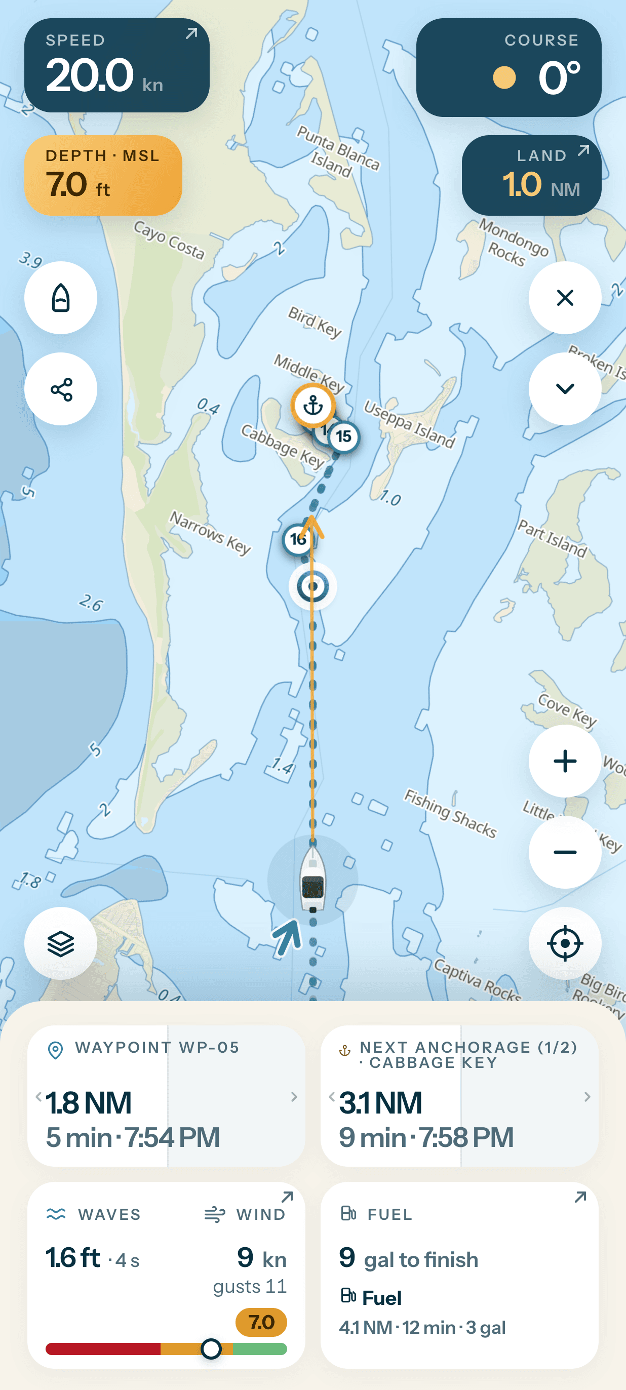
- Where you are and where you are pointing. Speed, course, and North up, Course up or Leg up orientation.
- Next waypoint and next anchorage. Distance, time and ETA, and on a multi-day route you pick the leg.
- The sea under you right now. Sea state and comfort at the boat’s exact position, with the wave direction relative to your course.
- Go now or wait? Comfort for the rest of the route if you leave now, or in one to six hours.
- Depth below the boat. Plus the distance to the nearest shore, so you stay on the right side of the coastal speed limit.
- Fuel to finish. And the fuel docks near the route and near the boat.
- Arrival notifications. Before an anchorage, with your own text and a snooze.
- It does not lose its place. The screen stays awake, and navigation resumes by itself after a phone lock or a crash.
- Simulation mode at home. Try the whole thing from the kitchen table, without leaving the house.
Keep watch at anchor
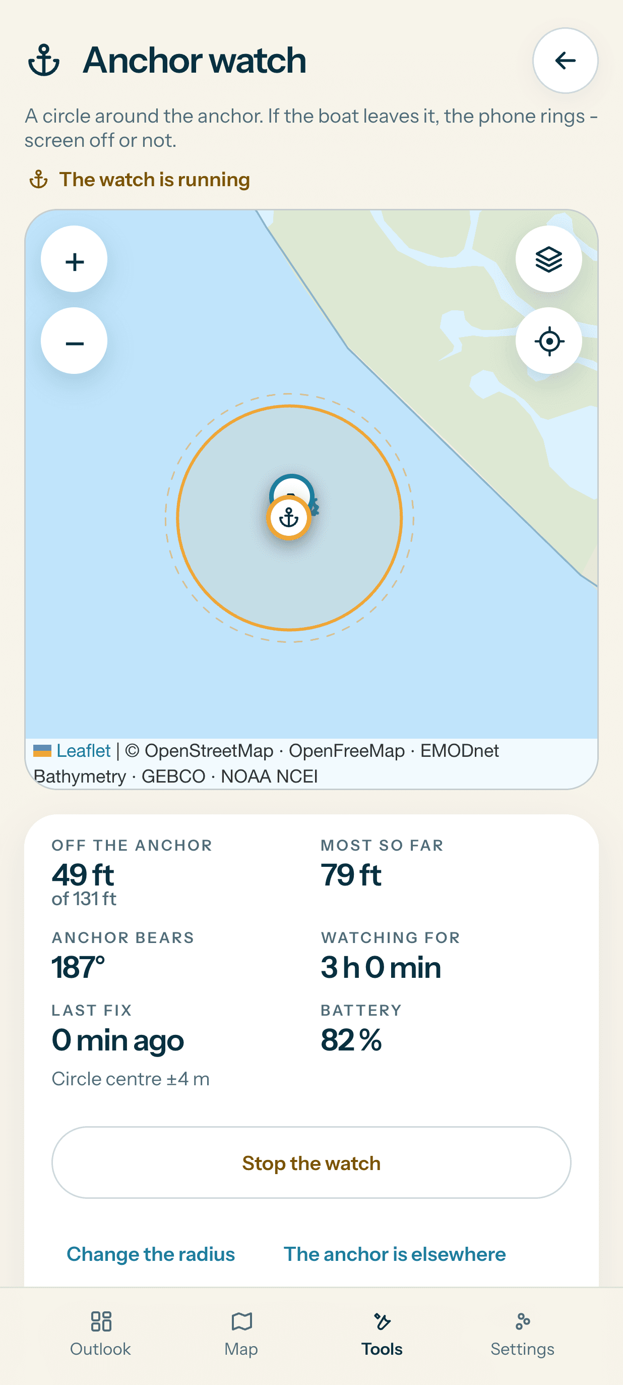
Set a circle around the anchor in the mobile app. If the boat leaves it, the phone sounds an alarm, even with the screen off. The watch shows distance, duration, the last position fix and battery level.
Find your day on the water.
Set your boat up once, and every route you care about gets a ten-day answer.
App StoreAvailable soonGoogle PlayAvailable soon
Start with Free when it lands. No card required.