Your perfect day for boating
Bonasea helps you pick a day you will enjoy on the water. It tells you what the sea and the weather will be like along the whole route you are planning, hour by hour, from the moment you leave to the moment you are back.
Once you are moving it answers the questions you ask at the wheel: how deep it is here, how far the nearest shore is, and where the next anchorage and fuel dock are.
A companion for boat owners and for anyone renting a boat on holiday.
Built by boaters, for boaters.
Three days free when it lands. No card to start.
- 10 daysof outlook, hour by hour
- Every 30 minthe whole route re-simulated
- 1 to 10comfort score, in half steps
- Worldwideweather and waves
The problem
The forecast you have is not the answer you need.
Six things an ordinary weather app cannot tell you about the day you are about to spend on the water.
Sunshine is not a calm sea.
You are on holiday and you want to rent a boat for a day or two. Nothing spoils it faster than picking the wrong day, and a forecast full of little suns tells you nothing about what the water will be doing. Bonasea tells you which day to book.
You already know where you want to go.
You have your boat and you have your favourite routes. The question is never where, it is when. Bonasea takes the trip you have in mind and finds the day it will be a pleasure rather than an endurance test.
Tomorrow’s sea is not today’s sea.
A cruise of three or four days is decided by when you start it. Flat water on Monday can mean a beam swell on Wednesday, halfway to the island you were heading for. Bonasea looks at the whole trip and tells you which departure day works for all of it.
One forecast is not enough.
Ordinary weather apps show waves at one point at one time. But you will be in an open channel at 10:00, anchored in a bay at 12:00, and heading home against the afternoon wind at 16:00.
A motorboat is not a sailboat.
What matters is where the waves come from relative to your course, their period and the swell underneath, not just their height. A one-metre wave hitting you from the side is a rough, rolling ride. The same one-metre wave coming from behind is a comfortable afternoon.
Your crew remembers the bad day.
Children, partner, guests. One uncomfortable leg is enough to spoil the whole trip, and to make the next one a negotiation.
Who it is for
However you get on the water.
Four ways in, and the same straight answer at the end of each one.
How it works
Three steps to the right day.
Set the boat up once. After that, every route you care about has an answer waiting for it.
Add your boat.
Pick your model from the database of common motorboats and the length, hull type, displacement and cruising speed fill themselves in, or set your boat’s characteristics yourself. Then set how much your crew tolerates: family, normal or sporty.
Click your route.
Ports, anchorages and your favourite spots are one tap away. Auto-route finds a way around the islands, checks the shallowest point along the track and warns you about cables and restricted areas.
Pick your day.
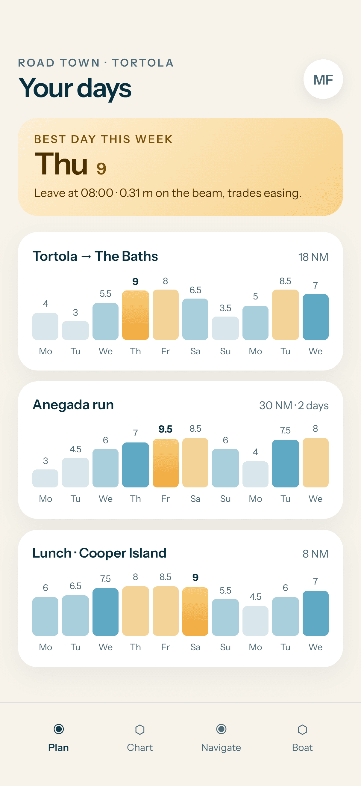
Bonasea shows a comfort score for every day and every departure hour, with waves resolved against your course on each leg and the lee of every island taken into account.
On board
From the sofa to the helm.
The plan gets you out of the marina on the right day. From then on the navigation screen answers the questions you actually ask at the wheel.
- Where you are and where you are going. Speed, course, next waypoint and next anchorage, with distance, time and ETA.
- The sea under you right now. Waves, swell and wind at the boat’s own position, with the wave direction relative to your course, and your comfort score for the moment.
- Go now or wait? The comfort of the rest of the route if you leave now, or in one to six hours.
- Depth below the keel. Live, from the chart, alongside the tide where tides matter.
- Distance to the nearest shore. So you can see when you are entering the slow zone along the coast and leave the speeding fine to somebody else.
- Fuel. Litres or gallons to finish, and the fuel docks near your track and near the boat.
- Arrival notifications. Two kilometres before the anchorage, saying whatever you want it to say. “Fenders out”, for example.
The chart
A nautical chart you do not have to buy.
Depth bands, contours and soundings from open hydrographic data, with the seamarks, terrain and places that make a chart worth looking at.
- Lighthouses and buoys, with their light characters.
- Terrain contours, so you can recognise an island by its silhouette.
- Anchorages, mooring buoys, fuel docks and the shore amenities around every bay.
- Wrecks, rocks, fish farms and restricted areas.
The map is a planning aid, not an official nautical chart. See coverage
Where Bonasea works
Wherever your boat meets the sea.
Comfort scores, navigation and the detailed nautical chart work anywhere your boat meets the sea. Each of these pages carries the local conditions that decide a day there.
Adriatic
Croatia · Slovenia · Italy · Montenegro
Greece
Ionian · Saronic Gulf · Cyclades · Dodecanese
Turkey
Bodrum · Marmaris · Göcek · Fethiye
Western Mediterranean
Balearics · Côte d’Azur · Liguria · Sardinia · Corsica
Caribbean
BVI · USVI · Antilles · Grenadines
Florida and the Bahamas
Florida · The Bahamas
US East Coast
Chesapeake · Long Island Sound · New England
US West Coast
California · San Francisco Bay · Puget Sound
Australia
Queensland · Whitsundays · Sydney · Perth
New Zealand
Hauraki Gulf · Bay of Islands · Marlborough Sounds
You can also download the map of your region for offline use, in case you lose mobile signal.
Start planning your season.
Your boat, your routes, and a straight answer for every one of them.
Three days free when it lands. No card to start.